Daniel Boone Byway

  • HTML tutorial

Dave Barnes

Rank 0

Contributor I

Hey everyone,

Trying to plan a weekend trip on 2/21 and head up to DBBB. I'm driving from north Alabama on the 20th, so that will give me two full days of riding.
I downloaded the map and started studying the area. I want to be able to ride all of it, but don't know if that's even possible in 2 days.
So I'm hoping someone that's been there/done that, can help me decide which trails I should definitely do and sites I need to see in those feel days.
Maybe get a good starting point and some street names to look for or directions of some kind. Oh yea, if anyone is interested in going, the more the better.

Thanks
 

Dustinfromohio

Rank III

Enthusiast II

693
Wooster, OH, USA
First Name
Dustin
Last Name
Parsons
Hey everyone,

Trying to plan a weekend trip on 2/21 and head up to DBBB. I'm driving from north Alabama on the 20th, so that will give me two full days of riding.
I downloaded the map and started studying the area. I want to be able to ride all of it, but don't know if that's even possible in 2 days.
So I'm hoping someone that's been there/done that, can help me decide which trails I should definitely do and sites I need to see in those feel days.
Maybe get a good starting point and some street names to look for or directions of some kind. Oh yea, if anyone is interested in going, the more the better.

Thanks
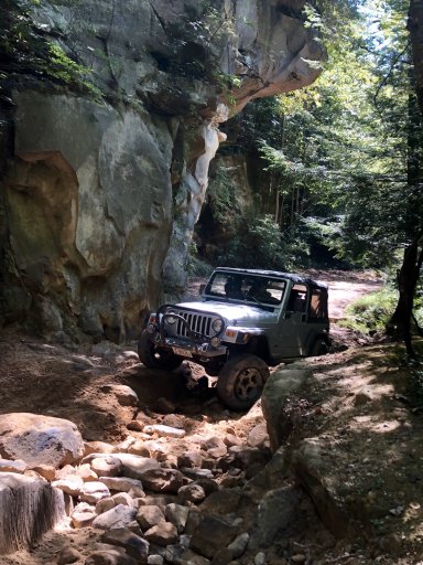
Dave, I completed the DBBB in its entirety in two days last fall and didn’t feel pressed for time in the least. What vehicle are you taking? I did it in a tj wrangler, 3” lift, 32” ATs, limited slip rear.

Couple thoughts in no particular order-

-northern end will probably be extremely muddy when you go, recovery gear is a must.
-Southern end was the most scenic/enjoyable for us but there was one fairly rocky section that was quite challenging.
-We downloaded Avenza map app and it was very helpful
-some of the places you see on YouTube (the overlook, the cave) are not actually on the DBBB but reside on private property near it and very difficult to locate without guidance
-Miguel’s is worth stopping at for a pint and some people watching

Feel free to hit me up if you need anything else!

Adjustments.JPGAdjustments.JPGAdjustments.JPG
 
  • Like
Reactions: DevilDodge

Dustinfromohio

Rank III

Enthusiast II

693
Wooster, OH, USA
First Name
Dustin
Last Name
Parsons
Hey ,
I'm taking a 12 Tacoma with 3in lift on 33's. Other than that its stock, but I do have a winch.
So where is the best place to start and did you camp?
Shouldn’t have any problems clearance wise, expect some pinstriping.

It’s recommended to run the trail counterclockwise starting at the blue iron bridge east of the Nada Tunnel. The avenza map details this really well.

We stayed in an A frame outside of Slade but there were tons of campers/spots along the initial couple miles north of the blue iron bridge, I’d maybe look there first
 
  • Like
Reactions: DevilDodge

Dave Barnes

Rank 0

Contributor I

Sorry for all the questions, just trying to gather has much information as possible, being we won't have anyone with us thats been. So will it consume 2 full days u think?
How much of the loop is pavement riding?
 
  • Like
Reactions: ckkphoto

Dustinfromohio

Rank III

Enthusiast II

693
Wooster, OH, USA
First Name
Dustin
Last Name
Parsons
Sorry for all the questions, just trying to gather has much information as possible, being we won't have anyone with us thats been. So will it consume 2 full days u think?
How much of the loop is pavement riding?

IMG_3350.JPG
This map shows all the paved sections. Take the difficulty ratings with a grain of salt because the map was made for adventure bikes. You can definitely fill two days worth, especially if you stop to enjoy some of the creek crossings, make a side stop to hike natural bridge state park, and check out some of the extra spurs.
 
  • Like
Reactions: DevilDodge