Member III
- 2,827
- First Name
- Joshua
- Last Name
- Downs
- Member #
-
20468
- Ham/GMRS Callsign
- KK6RBI / WQYH678
- Service Branch
- USMC 03-16, FIRE/EMS
Spent a few days in the Ouachitas for a motorcycle event called Rich Mountain Rendezvous. It's a charity event that benefits CASA. I used to go on motorcycles but ride a lot less than I used to and for the past two years have taken the CJ5. I wanted to take my CJ2 but the transmission is currently in a lot of parts on a table waiting on parts. Spent 2 full days expanding my exploration of the area and dropping more pins for campsites. At this point my collection of campsite pin drops is quite extensive and grows every time I go up in that area.
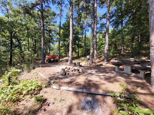
A nice campsite that isn't marked on the map but was established the FS at some point. Very nice view. Unfortunatly someone built another fire ring right in a prime tent spot right next to the metal firering the FS put in.
An area that's marked as a strip mine on the map. I came out of the woods in the background after navigating a dry creek bed marked as a road on the maps. Very strange open space devoid of trees, even the grass almost looked like it had been cut.
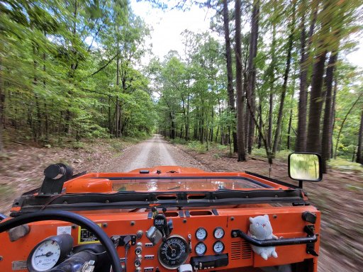
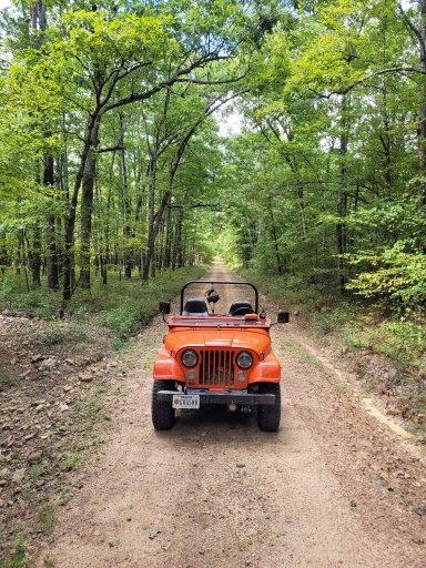
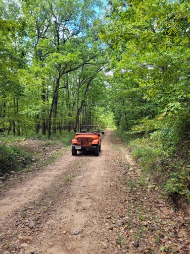
Little bit of cruising on a very smooth section of FS road.
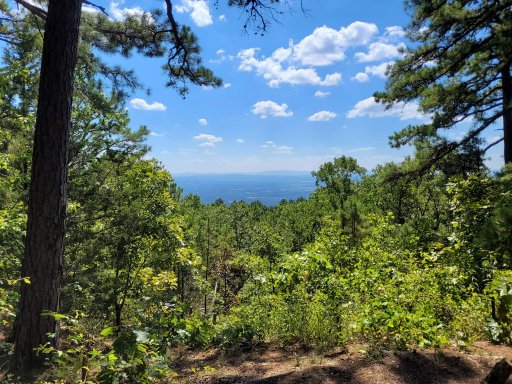
For some reason the pictures loaded out of order, but this is the view from the campsite mentioned above that was set up by the FS but not on any of my maps.
Lots of logging activity in this area. This spot was beat down by the tracked vehicles so much it had turned the dirt into moon dust that made huge dust clouds every time the wind blew.
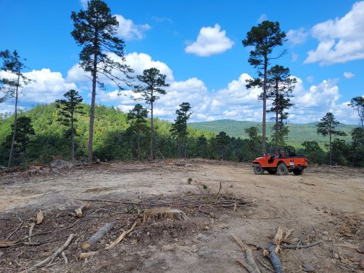
Another view of the strip mine area.
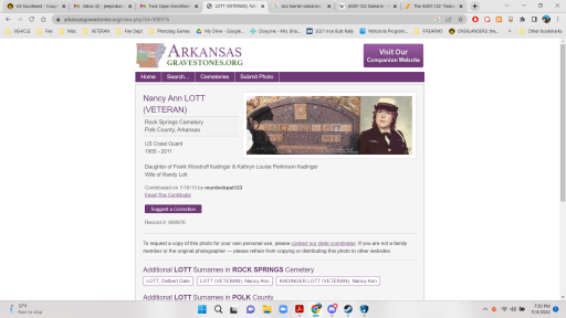
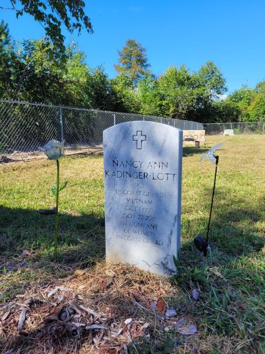
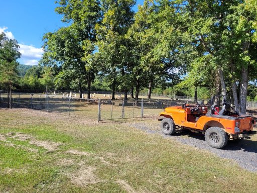
Came across a back road cemetery, I typically stop and check them out, and this gravestone caught my eye.
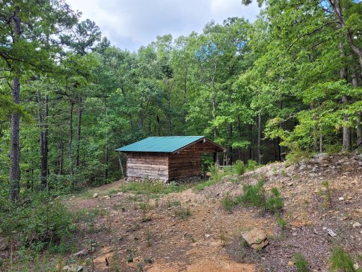
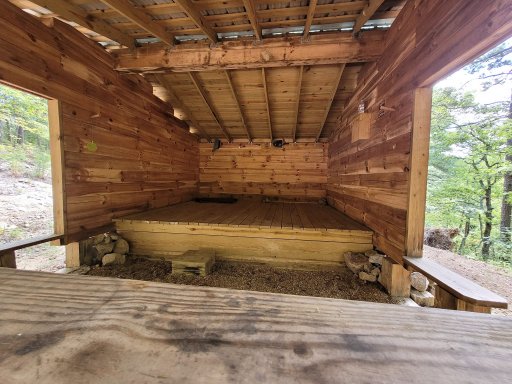
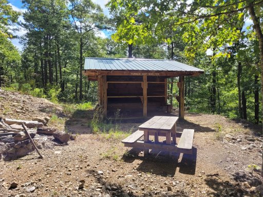
Ouachita Trail hiking shelter. Stumbled across it when I spotted the roof though the woods about 100 yards from the vehicle trail.
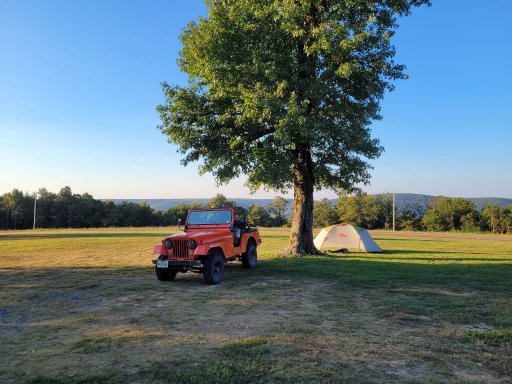
My campsite at Queen Wilhelmina State Park. Usually you have to camp at the end of the rv camp road in a little cul-de-sac but for this even they lift that rule, and we can set up our tents wherever for the most part.
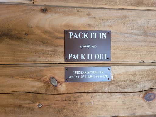
Inside the hiking shelter. These are spaced along the hiking trail.
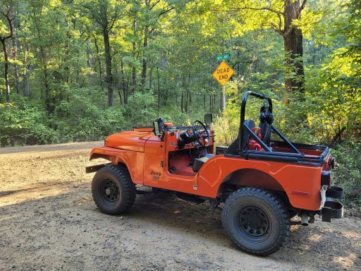
Seems kind of weird to have this street sign in the middle of nowhere.
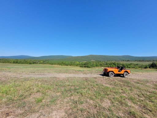
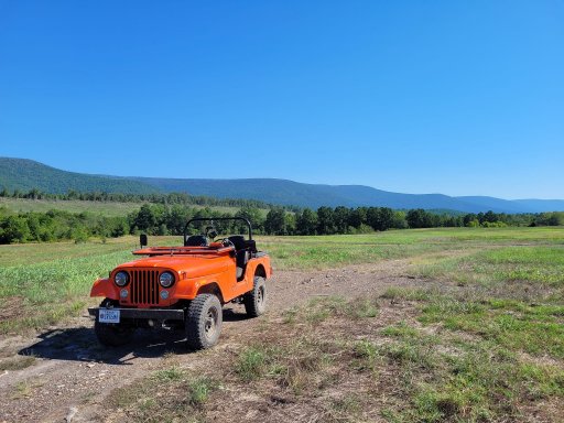
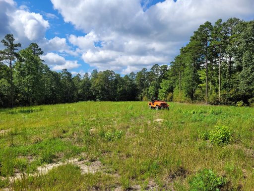
Large open meadow I came across, would make for a great large group camp site if needed. There's about 50-75 more yards of meadow behind me, and the whole thing was about 100-150 yards wide.
Gate of the cemetery I found the Coastie headstone at. There's a sign up by the paved road and you drive down this short drive about 200 yards though a hay field.
That's it. Good trip as usual. I'm always ready to get back up there. Since it's only 2-3 hours away from me I try to go often.
A nice campsite that isn't marked on the map but was established the FS at some point. Very nice view. Unfortunatly someone built another fire ring right in a prime tent spot right next to the metal firering the FS put in.
An area that's marked as a strip mine on the map. I came out of the woods in the background after navigating a dry creek bed marked as a road on the maps. Very strange open space devoid of trees, even the grass almost looked like it had been cut.
Little bit of cruising on a very smooth section of FS road.
For some reason the pictures loaded out of order, but this is the view from the campsite mentioned above that was set up by the FS but not on any of my maps.
Lots of logging activity in this area. This spot was beat down by the tracked vehicles so much it had turned the dirt into moon dust that made huge dust clouds every time the wind blew.
Another view of the strip mine area.
Came across a back road cemetery, I typically stop and check them out, and this gravestone caught my eye.
Ouachita Trail hiking shelter. Stumbled across it when I spotted the roof though the woods about 100 yards from the vehicle trail.
My campsite at Queen Wilhelmina State Park. Usually you have to camp at the end of the rv camp road in a little cul-de-sac but for this even they lift that rule, and we can set up our tents wherever for the most part.
Inside the hiking shelter. These are spaced along the hiking trail.
Seems kind of weird to have this street sign in the middle of nowhere.
Large open meadow I came across, would make for a great large group camp site if needed. There's about 50-75 more yards of meadow behind me, and the whole thing was about 100-150 yards wide.
Gate of the cemetery I found the Coastie headstone at. There's a sign up by the paved road and you drive down this short drive about 200 yards though a hay field.
That's it. Good trip as usual. I'm always ready to get back up there. Since it's only 2-3 hours away from me I try to go often.