A few weekends ago some friends and I explored the Shaver Lake area. I had been to Courtright Reservoir and run part of the Dusy Trail before, but I had not been on any of the trails around Shaver.
We were amazed at the size of the scar from the 2020 Camp Fire, and what we saw was only a small portion. The Tamarack fire was burning near Markleeville during our trip and while there was noticeable smoke it was not too bad at the higher altitudes.
There are many descriptions of the area (especially Bald Mountain) on this site so I am not going to go into much detail. Instead I will just give a quick overview of our route, and then share some photos.
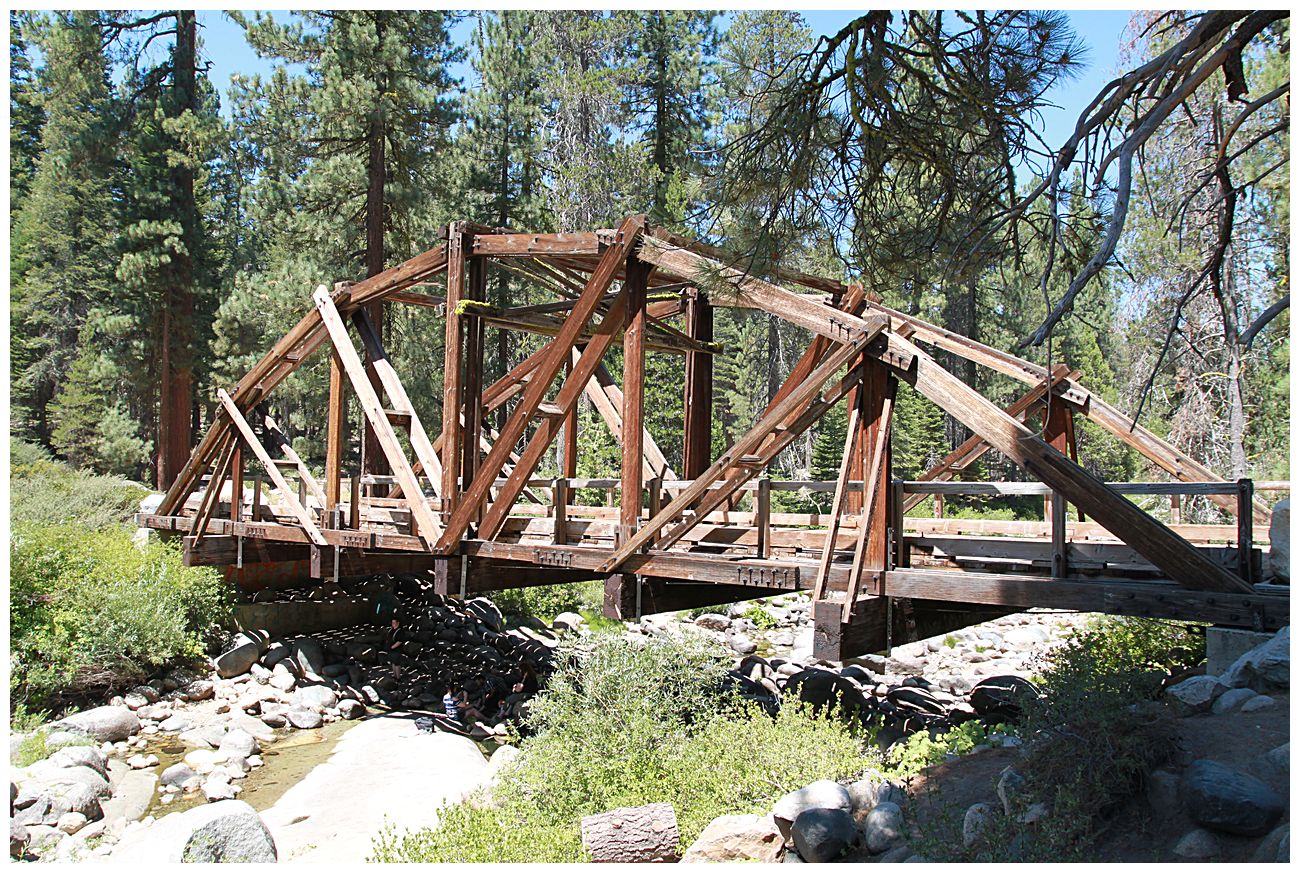
We drove from the Bay Area to Shaver Lake on Saturday morning and then headed SE towards Dinkey Creek to check out the historic bridge there and have lunch. We had hoped to also see the McKinley Grove of giant sequoias, but decided to visit it another time with our families and to reserve this trip for offroading.
After lunch we headed back to Rock Creek Road to survey some potential campsites and then head up Bald Mountain. There are some decent sites right near the junction with Dinkey Road which are marked on the Gaia link below. You may notice that my track is a bit wonky, this is because Gaia was periodically losing GPS signal during the trip for some reason.
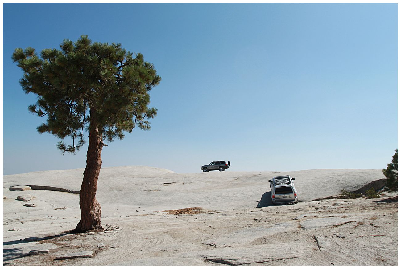
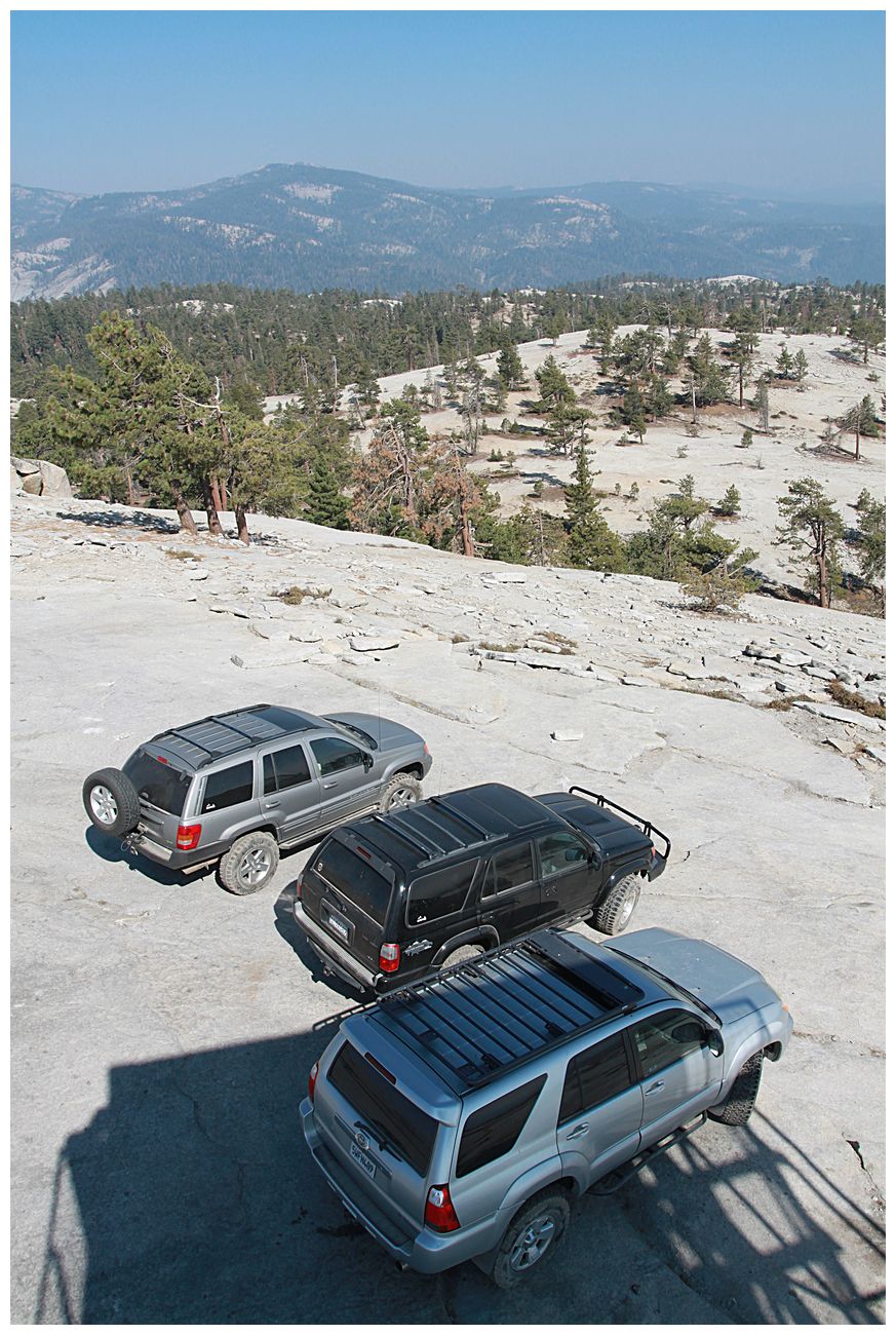
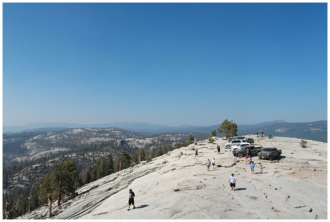
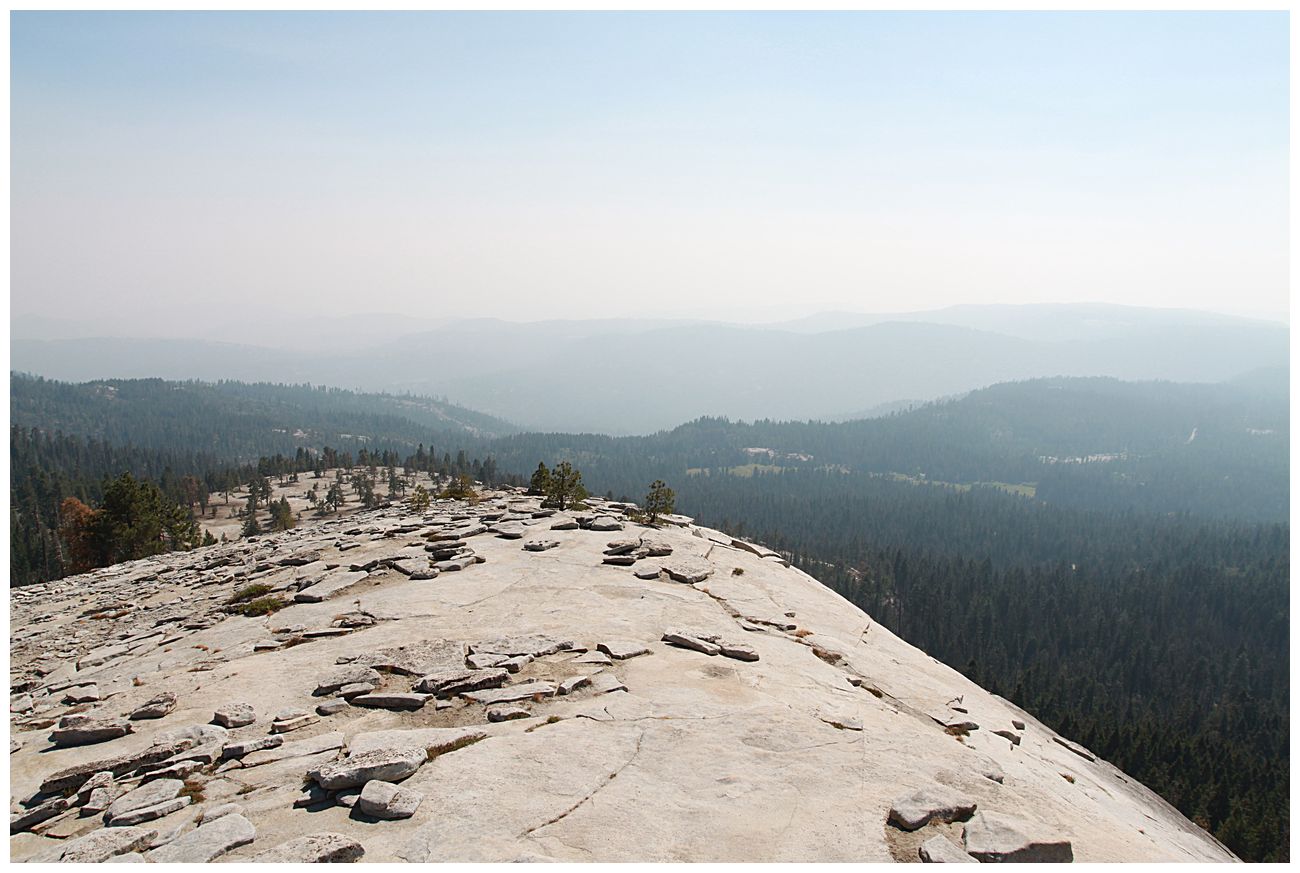
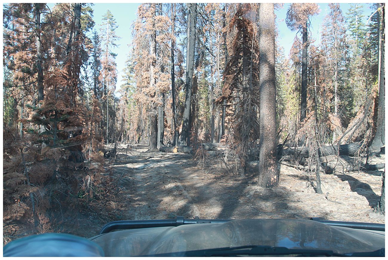
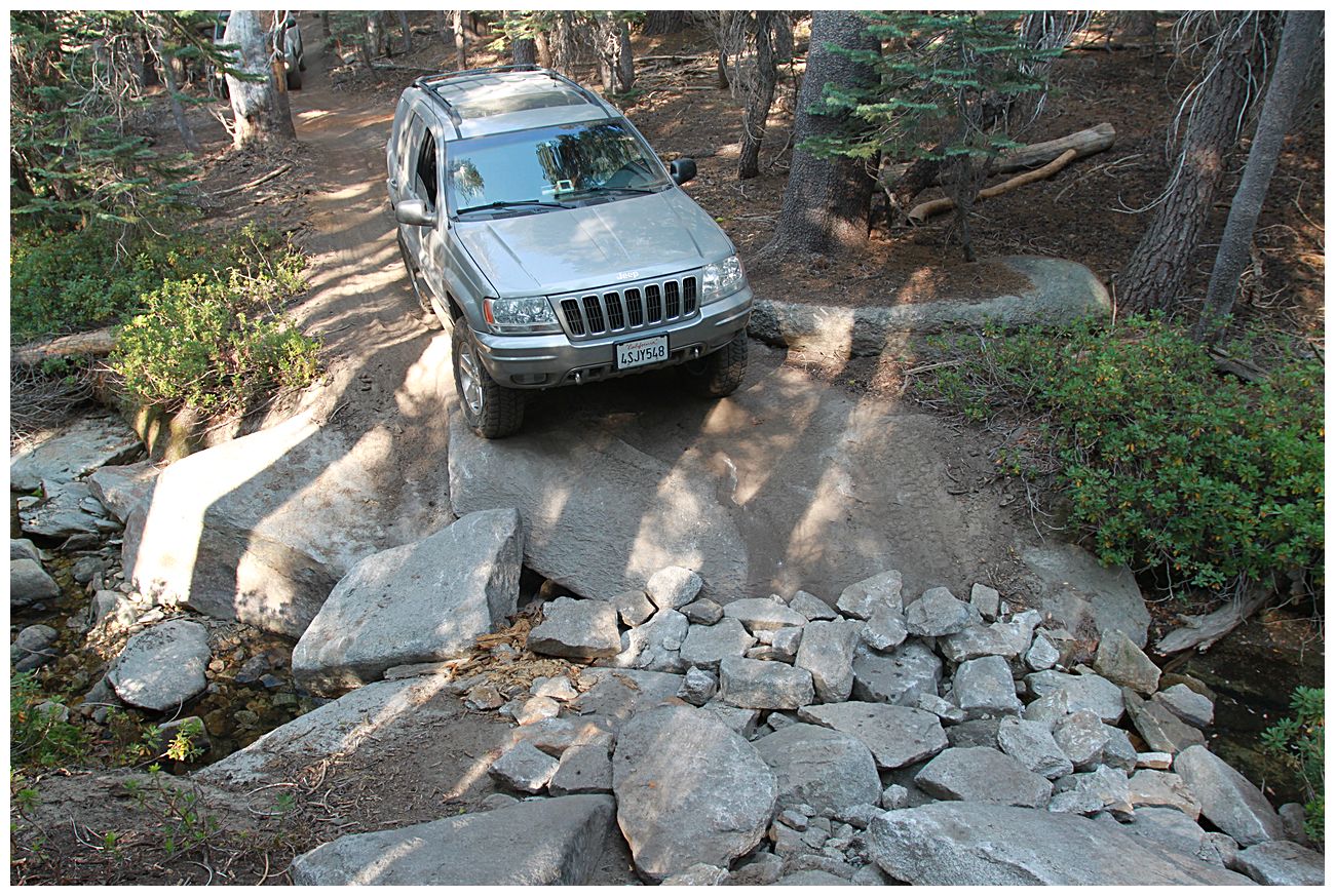
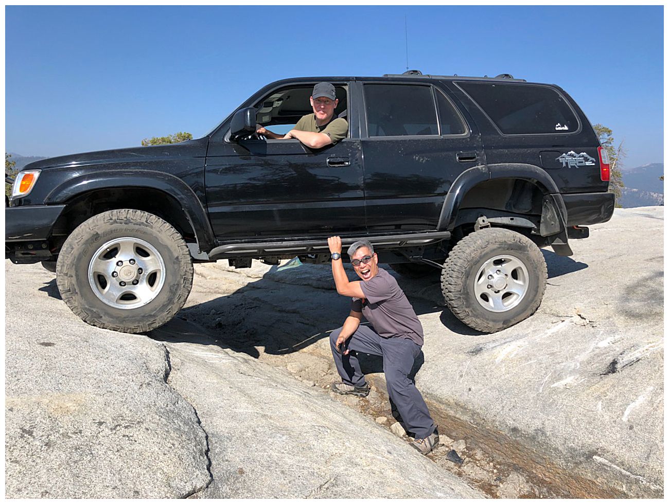
We took the southern "intermediate" route to the top of Bald Mountain. This was rocky and had some obstacles, but nothing that required spotting and we had no issues. For context, all 3 trucks had small lifts, 32" tires, and rock sliders. Unfortunately the smoke somewhat obscured the view from the tower, but it was still worth visiting. After visiting the tower we headed north and played around on the slabs where there is a crack that is like a junior version of the "Golden Crack " in Moab. Then we headed north and connected together a series of narrow trails, one of which went through a burned out area full of ash and dead trees. There was one water crossing with a good drop off on the side where we used a spotter for safety.
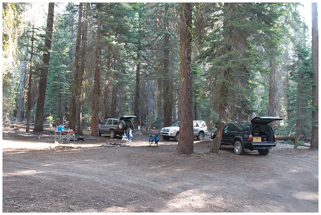
Once back on Rock Creek we headed south intending to camp at the spot we had checked out earlier, but to save driving time we ended up camping a few miles up a side road.
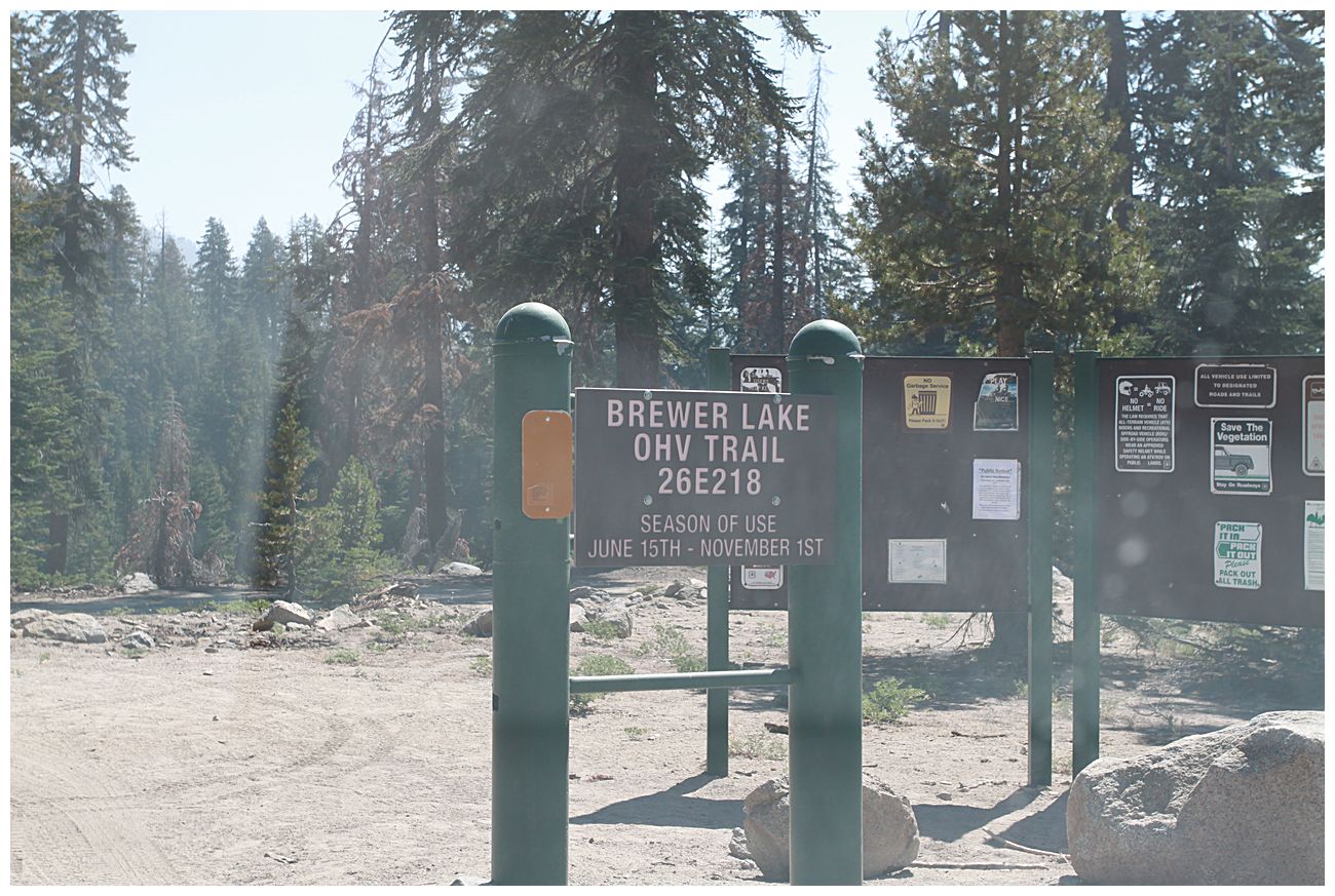
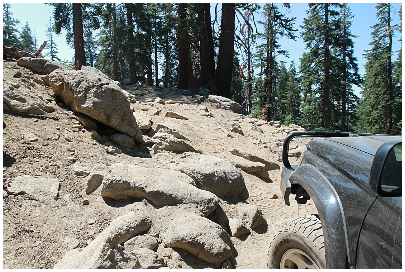
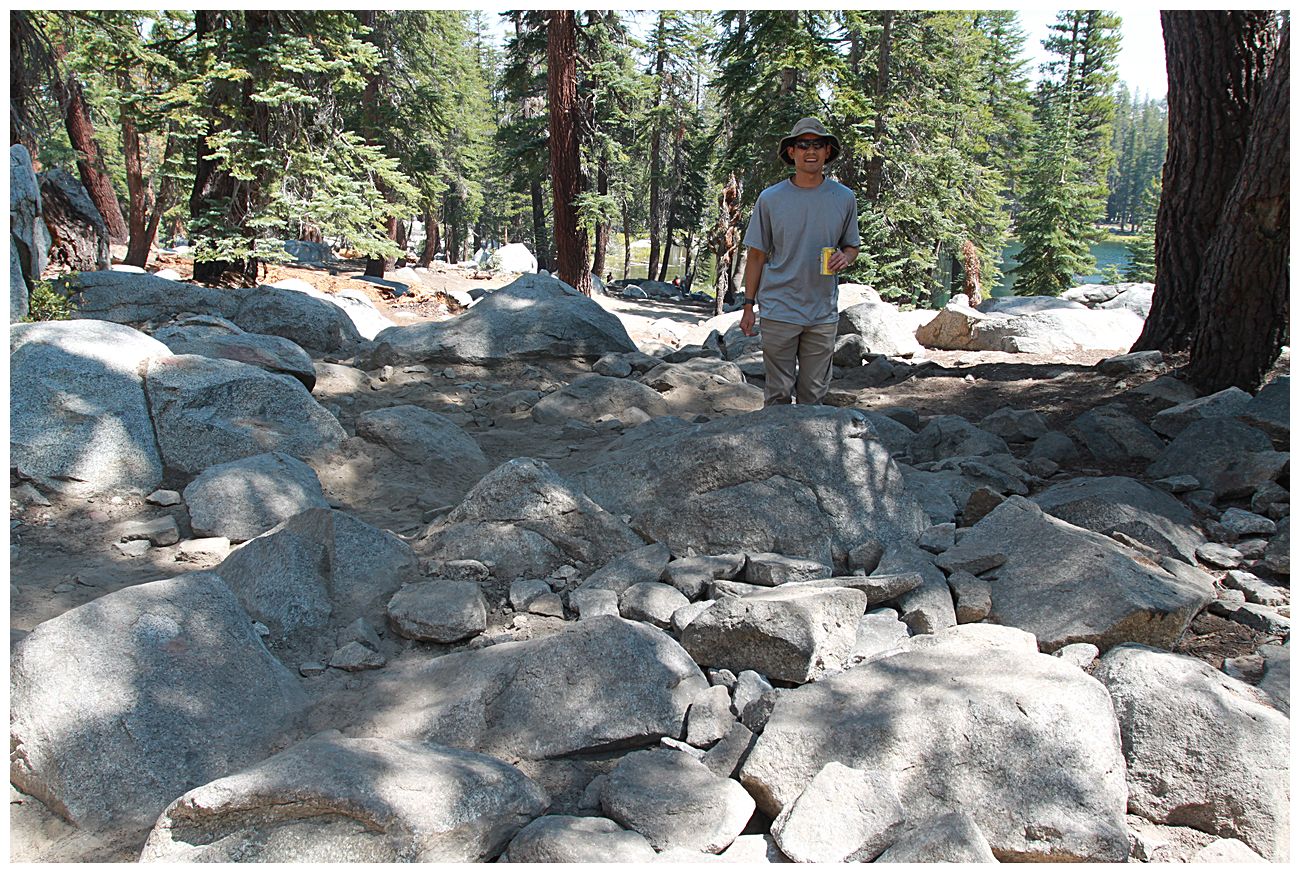
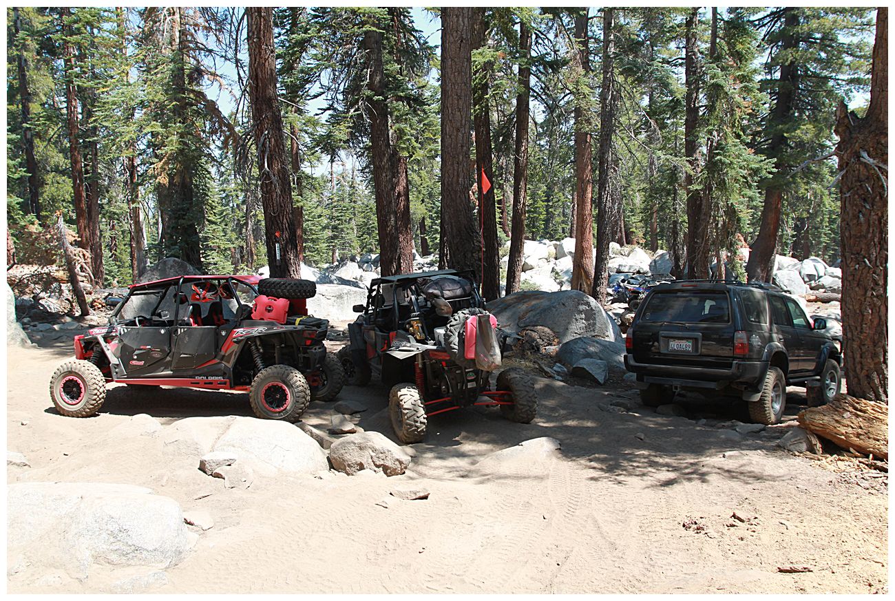
The next morning we followed the signs to the start of the Brewer Lake trail. The marked route was surprisingly long and bumpy, it's the large loop to the east on Gaia map. The Brewer Lake trail is quite short (~3 miles) and the beginning part goes along a ridge and is easy. The first real obstacle is a slightly offcamber uphill section with a drop off. Wide wheelbase rigs would need to "ramp" a rock on the right side which would tip them towards the dropoff. Narrower rigs can drive around the rock by staying close to the edge, just keep your passenger side tires on the trail. The last 1/2 mile or so was more difficult and I had to use my rear locker in some places since my 4Runner is a stick shift and doesn't have a great crawl ratio. We drove down to within about 100 yards of the lake, and encountered some very large rocks and a group of side-by-sides blocking the trail. We parked and walked the last bit of trail to a nice campsite near the lake. We probably could have driven it, but it would have been rough on the trucks and taken considerable time, and we would have needed the side-by-sides to move. After checking out the lake we headed back out the way we came in. Overall it was an enjoyable trail, technical enough to be interesting, we had no problems and nobody got stuck.
I didn't want to take the "official" long loop back to Rock Creek Road so we headed west on a shortcut that appeared to connect to the main trail. This was a bit narrow and rocky, but not a problem and it saved us considerable time. Once on Rock Creek we headed north through more burned out areas and then up 168 to check out Huntington Lake where we had a picnic lunch. Oddly, after lunch my 4Runner didn't want to start and just made a "whirring" noise without having the starter engage the flywheel. 3rd gen 4Runners are known to have issues with solenoid contacts which I suspect is the problem. After tapping the starter with a rubber mallet it worked properly and we headed back towards home. Of course the truck has been 100% fine since then, but I've ordered new starter contacts and will replace them at some point.
There are several other places I want to visit in the area (Mirror Lake, Coyote Lake, Strawberry Lake, Kaiser Pass, Lake Thomas A Edison, Florence Lake, Bear Creek), and we will definitely be heading back in the future.
Here are some points of interest and a track of our trip.
 www.gaiagps.com
We were amazed at the size of the scar from the 2020 Camp Fire, and what we saw was only a small portion. The Tamarack fire was burning near Markleeville during our trip and while there was noticeable smoke it was not too bad at the higher altitudes.
There are many descriptions of the area (especially Bald Mountain) on this site so I am not going to go into much detail. Instead I will just give a quick overview of our route, and then share some photos.
We drove from the Bay Area to Shaver Lake on Saturday morning and then headed SE towards Dinkey Creek to check out the historic bridge there and have lunch. We had hoped to also see the McKinley Grove of giant sequoias, but decided to visit it another time with our families and to reserve this trip for offroading.
After lunch we headed back to Rock Creek Road to survey some potential campsites and then head up Bald Mountain. There are some decent sites right near the junction with Dinkey Road which are marked on the Gaia link below. You may notice that my track is a bit wonky, this is because Gaia was periodically losing GPS signal during the trip for some reason.
We took the southern "intermediate" route to the top of Bald Mountain. This was rocky and had some obstacles, but nothing that required spotting and we had no issues. For context, all 3 trucks had small lifts, 32" tires, and rock sliders. Unfortunately the smoke somewhat obscured the view from the tower, but it was still worth visiting. After visiting the tower we headed north and played around on the slabs where there is a crack that is like a junior version of the "Golden Crack " in Moab. Then we headed north and connected together a series of narrow trails, one of which went through a burned out area full of ash and dead trees. There was one water crossing with a good drop off on the side where we used a spotter for safety.
Once back on Rock Creek we headed south intending to camp at the spot we had checked out earlier, but to save driving time we ended up camping a few miles up a side road.
The next morning we followed the signs to the start of the Brewer Lake trail. The marked route was surprisingly long and bumpy, it's the large loop to the east on Gaia map. The Brewer Lake trail is quite short (~3 miles) and the beginning part goes along a ridge and is easy. The first real obstacle is a slightly offcamber uphill section with a drop off. Wide wheelbase rigs would need to "ramp" a rock on the right side which would tip them towards the dropoff. Narrower rigs can drive around the rock by staying close to the edge, just keep your passenger side tires on the trail. The last 1/2 mile or so was more difficult and I had to use my rear locker in some places since my 4Runner is a stick shift and doesn't have a great crawl ratio. We drove down to within about 100 yards of the lake, and encountered some very large rocks and a group of side-by-sides blocking the trail. We parked and walked the last bit of trail to a nice campsite near the lake. We probably could have driven it, but it would have been rough on the trucks and taken considerable time, and we would have needed the side-by-sides to move. After checking out the lake we headed back out the way we came in. Overall it was an enjoyable trail, technical enough to be interesting, we had no problems and nobody got stuck.
I didn't want to take the "official" long loop back to Rock Creek Road so we headed west on a shortcut that appeared to connect to the main trail. This was a bit narrow and rocky, but not a problem and it saved us considerable time. Once on Rock Creek we headed north through more burned out areas and then up 168 to check out Huntington Lake where we had a picnic lunch. Oddly, after lunch my 4Runner didn't want to start and just made a "whirring" noise without having the starter engage the flywheel. 3rd gen 4Runners are known to have issues with solenoid contacts which I suspect is the problem. After tapping the starter with a rubber mallet it worked properly and we headed back towards home. Of course the truck has been 100% fine since then, but I've ordered new starter contacts and will replace them at some point.
There are several other places I want to visit in the area (Mirror Lake, Coyote Lake, Strawberry Lake, Kaiser Pass, Lake Thomas A Edison, Florence Lake, Bear Creek), and we will definitely be heading back in the future.
Here are some points of interest and a track of our trip.
Gaia GPS: Navigate, Track, and Explore
Plan trips and record GPS tracks for free, with the best outdoor app. Browse hiking trail maps, hunting units, and scout offroad camping trips. Buy a membership to download maps, including topos, aerial imagery, public/private land ownership, and National Geographic.