

In October I went on a small camping trip in the '66 VW. Several years back I built a small sleeping platform for inside the car that is installed after removing the passenger seat and back seat. With a foam pad and a sleeping bag, the little VW becomes a very basic camper. I stack my food, camp stove and suitcase behind the driver's seat. Tools, spare parts, water and hiking boots go under the platform. The car's small size requires a minimalist mindset for packing, but it has served me well for over a decade.
I drove west across Wisconsin on US-18 to the border with Iowa and Minnesota along the upper Mississippi River. Except for traffic in Madison, the drive was enjoyable. There are several state parks and campgrounds along the river on both the Wisconsin side and the opposite side. To me, the Mississippi River valley is one of the most beautiful places in the upper Midwest. I was pleasantly surprised the first time I came through the area when crossing into Dubuque, IA on my way west in 2015.
The first two nights I camped at Wyalusing State Park. There are some campsites along the edge of the ridge that overlook the confluence of the Wisconsin and Mississippi Rivers. Unfortunately, they were all full, except for one right along the main road in and out of the park next to the concession stand. I decided to get a site at the lesser-used campground in the woods further back from the river. It was much quieter there, and since my main daily activity would be hiking in the bluffs along the river, I wasn't disappointed.
After getting a campsite, I went for a walk along the Sugar Maple trail and Sentinel Ridge trail. The Sugar Maple trail winds its way down the bluffs through a forest of large oaks and maples as the name implies. I heard and saw lots of red-headed woodpeckers while walking this trail. Along the Mississippi River is the only place where I usually see these woodpeckers in the region. I have read that they are in decline nationwide. A reason has not been determined, but as a bird that seems to prefer oak forests with mature old trees, habitat loss is probably a likely scenario. In any case, I always enjoy the abundance of these striking birds in the wooded bluffs along the river.
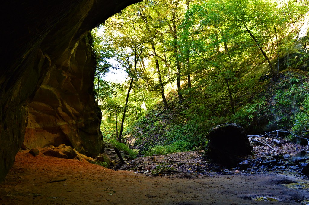
There is a spur trail that branches off the Sugar Maple trail and leads to a cave with a little waterfall pouring over the roof above. There is a large rock at the mouth of the cave that I enjoy sitting on while listening to the water from the fall landing just behind me. The cave is fairly large and was evidently used by Native Americans for many years as a shelter during the cold winter months. Sitting here, it is easy to imagine a group of people gathering around a warm fire under the cave's roof while looking out as snow fell and covered the surrounding forest.
Eventually the trail reaches the bottom of the hills and ends at a park road that crosses a set of railroad tracks before reaching the bank of the Mississippi. At the river there is a small fishing pier where two old men are tending several poles. I sat down on the trunk of a fallen tree at the river's edge and relax a while. A pair of bald eagle's soar and screech overhead while minnows jump and plop in the shallows along the shore. Chickadees chirp and flutter around in the scrub along the banks. After resting at the river, I crossed back over the railroad tracks and started back up the bluffs on the Sentinel Ridge trail.
The first half of the Sentinel Ridge trail is narrow, rocky and fairly steep in spots. It does not seem to be very heavily traveled. Near the top of the hill there are a number of Chinquapin oaks which are fairly rare in most of Wisconsin. The bark of the tree is somewhat similar to a white oak, only blockier, but the leaves have unmistakable saw-toothed edges that resemble no other oak leaves. Besides one small, wooded area near where I live, I have only seen Chinquapin oaks in Wisconsin along the Mississippi River.
At the top of the ridge, I rested at the Passenger Pigeon Monument which is at one end of an overlook. There is a nice stone wall which makes an excellent spot to stretch out on. After the monument, the Sentinel Ridge Trail becomes wider and is much more heavily used. There are a couple of huge basswood trees along this stretch of the trail. There are also clusters of large white pines on the cooler north facing slopes. One of them bears a gash twisting around the length of its trunk from a lightning strike a few years back. I was out here the day after the storm and remember seeing the shards of wood that were blown off the tree scattered on the ground, some blasted almost 100 feet away. The pine has survived the strike but will bear the scar for the rest of its days.
The trail eventually reaches a large clearing that overlooks where the Wisconsin River flows into the Mississippi. Beyond that point is a broad plain where the city of Prairie Du Chien is situated, and beyond the city there are more hills. I retraced my way back along the Sentinel Ridge trail down to the river and then climbed back up the Sugar Maple trail. Back at the campsite I made dinner. I'm no camp gourmet, and my dinners for this trip consisted of a pot of rice and a can of soup. I read for a while until it got too dark and the I went to bed. My old foam pad is not comfortable for me anymore. I would sleep for a few hours straight before waking up sore and shifting around to sleep another hour or so and repeat. Just before dawn, several coyotes were howling wildly not too far away.
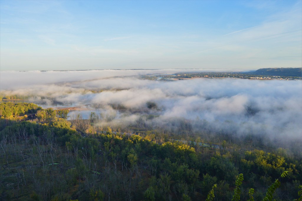
I ate a pot of oatmeal and a can of peaches for breakfast and then went to the Wisconsin/Mississippi overlook to watch the sunrise. The whole valley was fogged in, but I was above it on the hilltop. It was mesmerizing to watch the fog slowly roll down the Wisconsin valley and join the fog in the Mississippi valley before piling up and over the Iowa bluffs on the other side. I sat there enjoying the scene for quite a while, until the sun had burned off much of the fog below.
Then I fired up the VW, drove through Prairie du Chien, and crossed the river into the small town of Marquette, Iowa. Here I turned north on state highway 73 and headed a few miles north to Effigy Mounds National Monument for another day of hiking. There are two sections to Effigy Mounds; the southern section which has more mounds but less river views, and the northern section which has more river views but less mounds. I hiked the northern section all the way to the end at Hanging Rock, about a six-mile round trip. The terrain at Effigy Mounds is similar to the Wisconsin side with a steep ascent up into the bluffs from the parking lot followed by many ups and downs through the hills and valleys at the top.
There are several overlooks along the trails, and I sat under the oak trees at the Fire Point Lookout for some time enjoying the shade and the cool breeze after the walk up the big hill. Bald eagles were calling out from the trees on the river islands down below, but I couldn't see them. Behind the lookout is a long line of conical and linear burial mounds from a long-ago culture. There are many Native American tribes that trace their ancestry back to the builders of these mounds. Current members of the tribes leave little offerings of tobacco in colorful cloth pouches tied to overlook railings and small tree branches near the mound groups.
The last two miles or so of trail back to Hanging Rock is not very heavily traveled. A lot of repair and maintenance has been done on this stretch of trail since the last time I hiked here. There used to be several steep sections of trail that had eroded into deep gullies and trenches. Those had been filled in with stones and graveled over, some with new stone boarders to try to direct water away from the trail. Eventually I reached Hanging Rock where I sat for a while looking out over the river from high above. The rock outcrop is fairly exposed but there are a couple of gnarly Junipers that provide some shade to sit under. In the distance to the south, I can see the hills of Wyalusing where I hiked the day before.
I walked back along the trail and down out of the hills to the parking lot where I got in the VW and headed a short distance back down highway 73 to a turnout along the river with a concrete pad and a couple of picnic tables. One table was in the shade of a large silver maple, so I sat down there and ate a couple of peanut butter sandwiches for lunch. After lunch I drove back across the river to Wyalusing where I spent the remainder of the afternoon hanging out around the lookout at the Passenger Pigeon Monument before heading back to my campsite. I made my dinner, read a bit and went to bed.
At some point in the night, I woke up sore again. I laid awake on my back looking up through the VW's rear window. Although the campsite was in the woods, there was a gap in the trees where I could see the sky overhead. It was totally clear with no moon and the stars were spectacular. As I laid there looking up, a shooting star blazed quickly across the sky. Over the course of the next half hour, I saw four shooting stars stream above me. I was oddly thankful that my uncomfortable worn-out sleeping pad allowed me to be awake to see that night's aerial display. At some point I fell back asleep again and awoke to a faint glow in the east.
I made my oatmeal and went back out to the same overlook from the morning before. There was no fog on the valley today and the sunrise was spectacular. I sat and ate a can of peaches while the valley below me gradually filled with golden light. Clouds began to thicken as the sun rose higher and I bid farewell to Wyalusing. I once again entered Prairie du Chien but instead of crossing the Mississippi on US-18, I continued north out of the city on State Highway 35. This was a beautiful stretch of road. Highway 35 is a two-lane strip of roadway that runs along a thin swath of land between the base of the bluffs and the river. I passed through several small towns before winding through the city of LaCrosse and continuing north to Perrot State Park for another hike in the hills and a night of camping.
I got a site and then began my hike up the trail to Brady's Bluff. At the top of the bluff, I rested a while. It had been mostly cloudy since the sunrise this morning, but a gap of blue had opened, and the sun came out for a bit. Overhead, a large flock of probably 100 pelicans were making their way south along the river. As I was sitting there an older man of about 70 or so came up from the other way. We talked for a bit about life and such. He had grown up just across the river in Minnesota and was one of those random really interesting people you'll sometimes run across while out hiking. After talking a while, we said goodbye and continued our separate ways along the trail. I walked along the Perrot Ridge Trail to another lookout where I was attacked by ladybugs. Yep, that was strange. I came back down through a forest of huge red oaks carpeted with a dense growth of ferns.
I went back to the campsite and cooked my rice and soup for dinner. The clouds had broken up and I watched the sun set through the trees and went to bed. I awoke uncomfortably in the middle of the night and noticed a faint high pitched buzzing sound. Mosquitos! I cannot stand them. I sleep with the windows cracked in the VW to avoid dampness and condensation. I need to make some window screens! I reached over and turned on a light and above me on the VW's headliner were perched about 30 mosquitos. I swatted them down one by one until I was sure they were all done for. But I would occasionally hear that faint buzz again and find another floating through the air toward me. Eventually all was quiet, so I closed the windows and went back to sleep.
In the morning the VW was all fogged up inside as expected, but I had made the night with only a few itchy bites on my arms and head. I had planned on heading further north to Interstate Park on the St. Croix River, but the weather was calling for rain and then below freezing temperatures at night. Not having a proper cold weather sleeping bag and not wanting to spend a day hiking in the rain, I decided to cut the trip short and head home. Even though it was less direct and longer, I opted to drive back down the scenic highway 35 before heading home again on US-18. The tops of the bluffs were shrouded in lifting fog as I made my way south next to the Mississippi. I gassed the VW up in Prairie du Chien and set off toward home.
All in all, this was a great trip, save for a couple things I need to take care of before the next outing. When I got home, I ordered a new, much nicer sleeping pad. The old one was a backpacking pad I got when I was about 20. Now nearing 40 and with lots of old skateboarding injuries, my back can't take sleeping on it anymore. I still need to make some window screens for the VW before I head out again. I also said that after a big trip several years ago and never did it, but this time I will...probably.
This May I plan to take a trip that I first wanted to do years ago; drive across Kansas end to end on only dirt roads. It may sound silly, but I first got the idea when I lived there in the mid 2000's and spent lots of time exploring dirt roads on my Honda C70 Passport scooter. I meant to do it back then but never did. I forgot about the idea for a long time, but now I'll have a chance to try. My drive across Kansas will coincide with a car show held at the college I graduated from, which should provide a nice halfway point for the trip.
Thanks for following along.
Tim
Here are some pictures from the trip.
The cave at Wyalusing State Park

View from inside the cave. The rock toward the right is a nice place to sit a while.
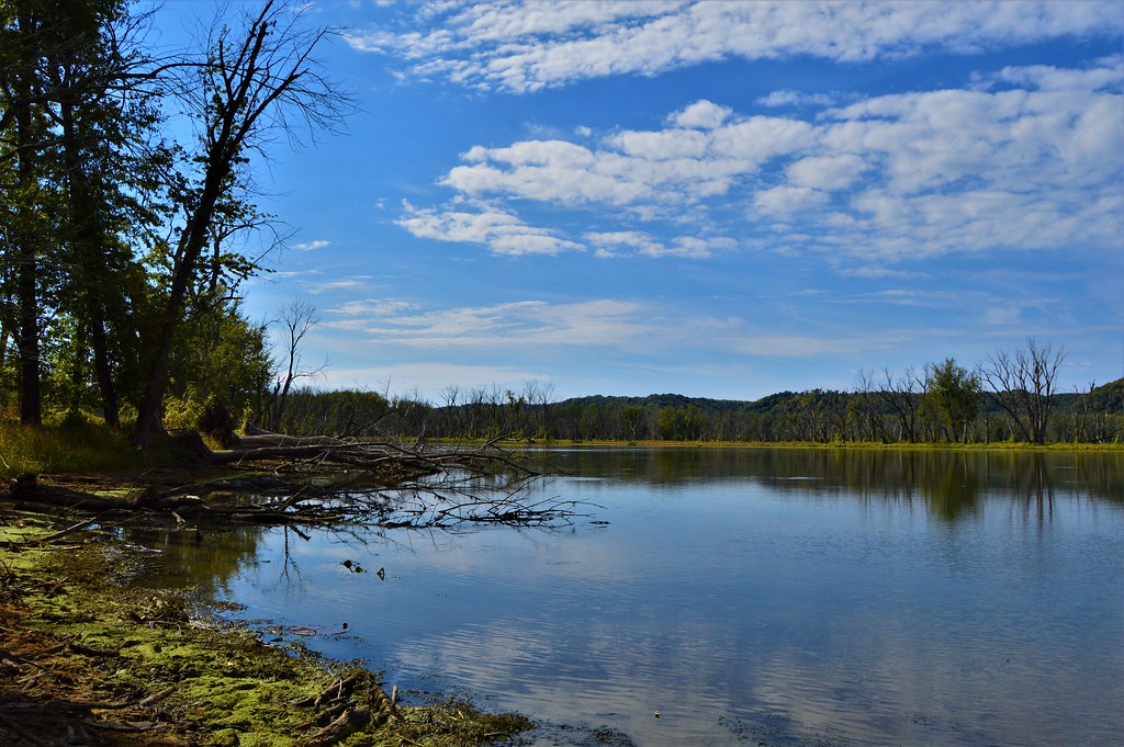
A backwater channel along the Wisconsin side of the Mississippi River.
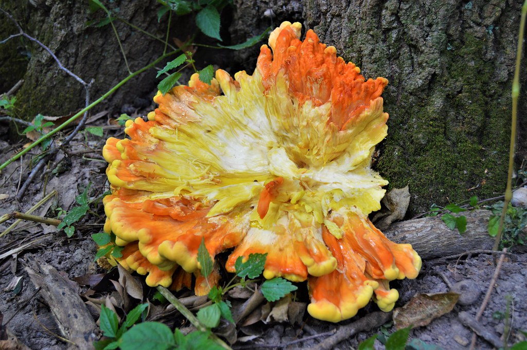
An interesting large mushroom growing at the base of an oak tree.
Sunrise over the foggy Wisconsin River valley.

Foggy Mississippi River valley. You can just see the Iowa bluffs in the distance with fog piling up and over them. Prairie du Chien is fog-free on the right.
The VW and a huge Cottonwood tree along the Mississippi River in Iowa.
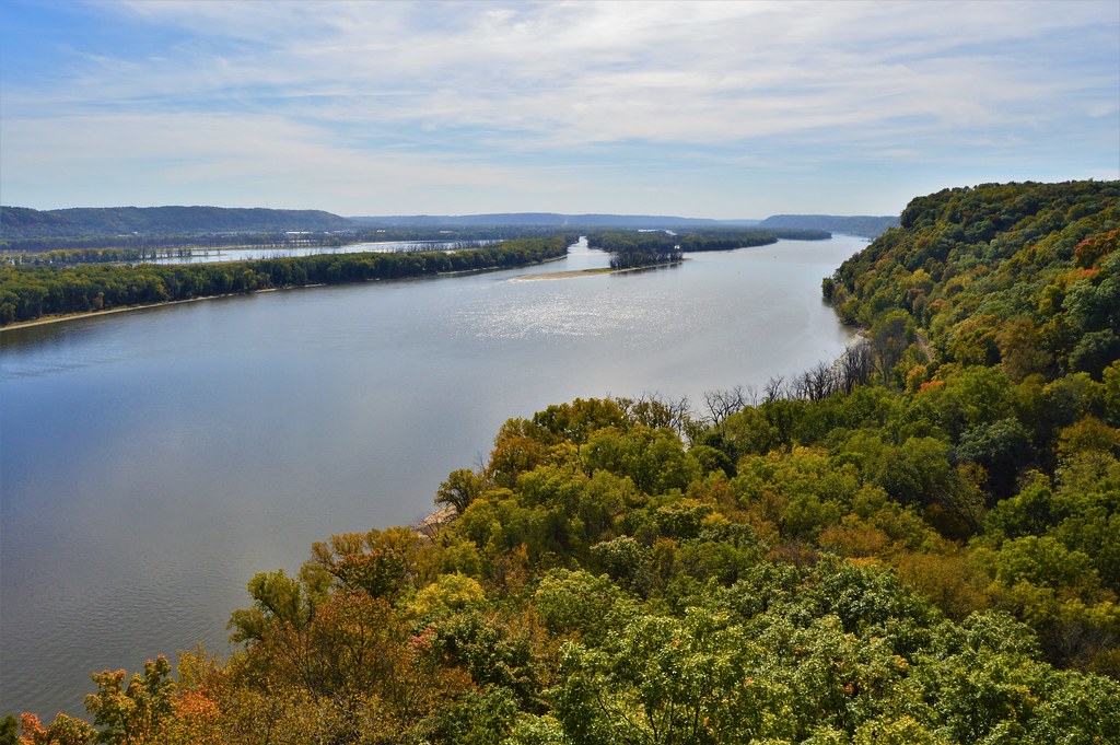
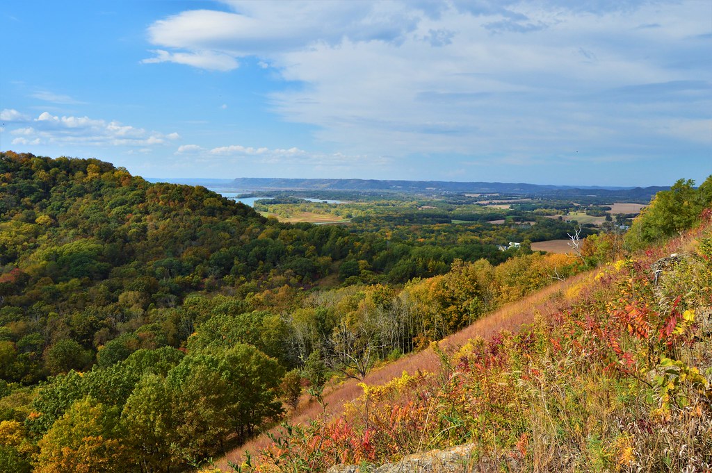
The Mississippi from the bluffs at Effigy Mounds National Monument. In the distance on the other side of the river at the center is Wyalusing.

Mushrooms on a basswood tree at Effigy Mounds.

The view from Hanging Rock at the end of the trail.
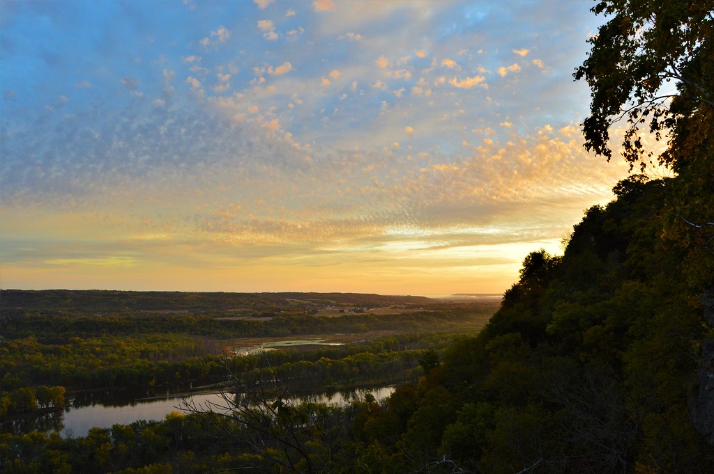
The second morning's sunrise over the Wisconsin River valley at Wyalusing.
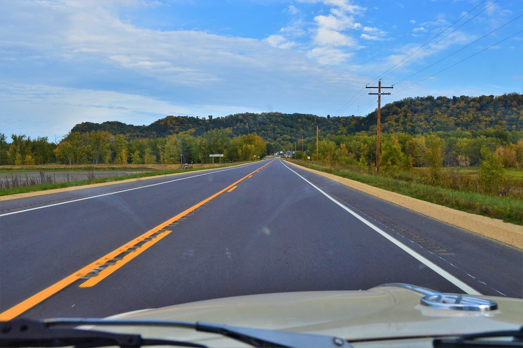
Wisconsin State Highway 35 north of Prairie du Chien.
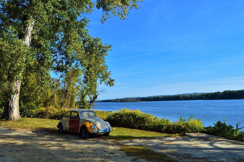
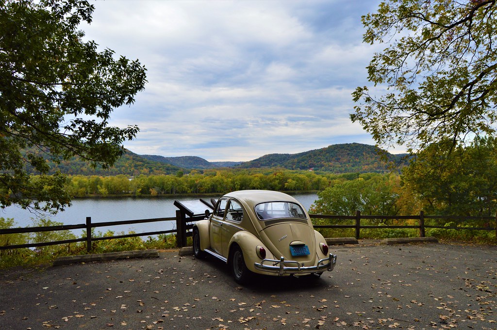
The VW and the Mississippi River at Perrot State Park. The bluffs in the distance are in Minnesota.
View from Brady's Bluff at Perrot State Park.

Looking north from on top of Brady's Bluff. The hill in the foreground is Trempealeau Mountain.

View from the Perrot Ridge looking back toward Brady's Bluff.

Another view from Perrot Ridge.
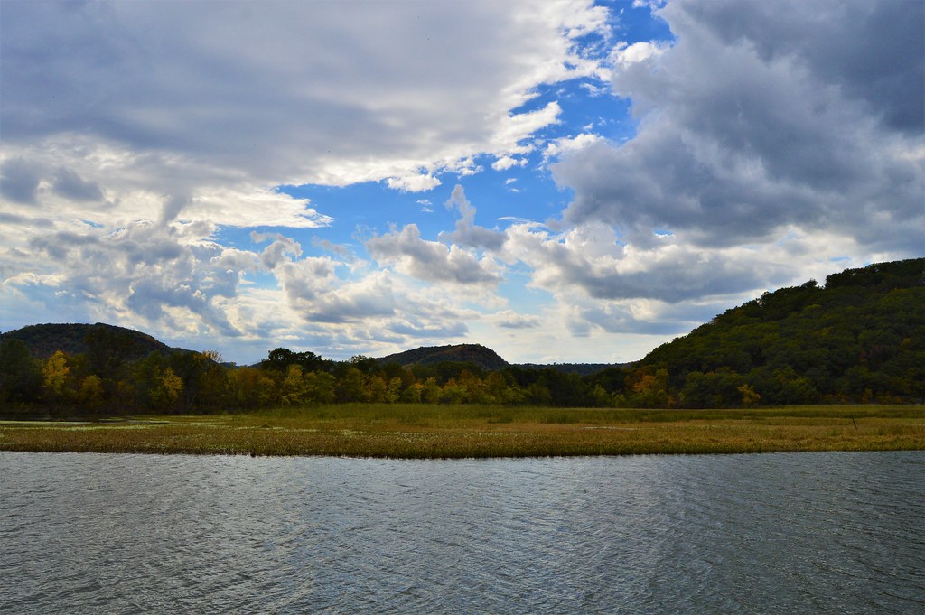
A marsh along the Mississippi River. I believe that is Trempealeau Mountain on the right.
Some fall color at Perrot State Park.

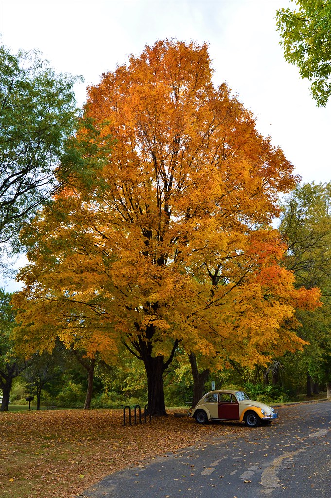
The VW under a big Sugar Maple.
Driving back home along State Highway 35.

I drove west across Wisconsin on US-18 to the border with Iowa and Minnesota along the upper Mississippi River. Except for traffic in Madison, the drive was enjoyable. There are several state parks and campgrounds along the river on both the Wisconsin side and the opposite side. To me, the Mississippi River valley is one of the most beautiful places in the upper Midwest. I was pleasantly surprised the first time I came through the area when crossing into Dubuque, IA on my way west in 2015.
The first two nights I camped at Wyalusing State Park. There are some campsites along the edge of the ridge that overlook the confluence of the Wisconsin and Mississippi Rivers. Unfortunately, they were all full, except for one right along the main road in and out of the park next to the concession stand. I decided to get a site at the lesser-used campground in the woods further back from the river. It was much quieter there, and since my main daily activity would be hiking in the bluffs along the river, I wasn't disappointed.
After getting a campsite, I went for a walk along the Sugar Maple trail and Sentinel Ridge trail. The Sugar Maple trail winds its way down the bluffs through a forest of large oaks and maples as the name implies. I heard and saw lots of red-headed woodpeckers while walking this trail. Along the Mississippi River is the only place where I usually see these woodpeckers in the region. I have read that they are in decline nationwide. A reason has not been determined, but as a bird that seems to prefer oak forests with mature old trees, habitat loss is probably a likely scenario. In any case, I always enjoy the abundance of these striking birds in the wooded bluffs along the river.
There is a spur trail that branches off the Sugar Maple trail and leads to a cave with a little waterfall pouring over the roof above. There is a large rock at the mouth of the cave that I enjoy sitting on while listening to the water from the fall landing just behind me. The cave is fairly large and was evidently used by Native Americans for many years as a shelter during the cold winter months. Sitting here, it is easy to imagine a group of people gathering around a warm fire under the cave's roof while looking out as snow fell and covered the surrounding forest.
Eventually the trail reaches the bottom of the hills and ends at a park road that crosses a set of railroad tracks before reaching the bank of the Mississippi. At the river there is a small fishing pier where two old men are tending several poles. I sat down on the trunk of a fallen tree at the river's edge and relax a while. A pair of bald eagle's soar and screech overhead while minnows jump and plop in the shallows along the shore. Chickadees chirp and flutter around in the scrub along the banks. After resting at the river, I crossed back over the railroad tracks and started back up the bluffs on the Sentinel Ridge trail.
The first half of the Sentinel Ridge trail is narrow, rocky and fairly steep in spots. It does not seem to be very heavily traveled. Near the top of the hill there are a number of Chinquapin oaks which are fairly rare in most of Wisconsin. The bark of the tree is somewhat similar to a white oak, only blockier, but the leaves have unmistakable saw-toothed edges that resemble no other oak leaves. Besides one small, wooded area near where I live, I have only seen Chinquapin oaks in Wisconsin along the Mississippi River.
At the top of the ridge, I rested at the Passenger Pigeon Monument which is at one end of an overlook. There is a nice stone wall which makes an excellent spot to stretch out on. After the monument, the Sentinel Ridge Trail becomes wider and is much more heavily used. There are a couple of huge basswood trees along this stretch of the trail. There are also clusters of large white pines on the cooler north facing slopes. One of them bears a gash twisting around the length of its trunk from a lightning strike a few years back. I was out here the day after the storm and remember seeing the shards of wood that were blown off the tree scattered on the ground, some blasted almost 100 feet away. The pine has survived the strike but will bear the scar for the rest of its days.
The trail eventually reaches a large clearing that overlooks where the Wisconsin River flows into the Mississippi. Beyond that point is a broad plain where the city of Prairie Du Chien is situated, and beyond the city there are more hills. I retraced my way back along the Sentinel Ridge trail down to the river and then climbed back up the Sugar Maple trail. Back at the campsite I made dinner. I'm no camp gourmet, and my dinners for this trip consisted of a pot of rice and a can of soup. I read for a while until it got too dark and the I went to bed. My old foam pad is not comfortable for me anymore. I would sleep for a few hours straight before waking up sore and shifting around to sleep another hour or so and repeat. Just before dawn, several coyotes were howling wildly not too far away.
I ate a pot of oatmeal and a can of peaches for breakfast and then went to the Wisconsin/Mississippi overlook to watch the sunrise. The whole valley was fogged in, but I was above it on the hilltop. It was mesmerizing to watch the fog slowly roll down the Wisconsin valley and join the fog in the Mississippi valley before piling up and over the Iowa bluffs on the other side. I sat there enjoying the scene for quite a while, until the sun had burned off much of the fog below.
Then I fired up the VW, drove through Prairie du Chien, and crossed the river into the small town of Marquette, Iowa. Here I turned north on state highway 73 and headed a few miles north to Effigy Mounds National Monument for another day of hiking. There are two sections to Effigy Mounds; the southern section which has more mounds but less river views, and the northern section which has more river views but less mounds. I hiked the northern section all the way to the end at Hanging Rock, about a six-mile round trip. The terrain at Effigy Mounds is similar to the Wisconsin side with a steep ascent up into the bluffs from the parking lot followed by many ups and downs through the hills and valleys at the top.
There are several overlooks along the trails, and I sat under the oak trees at the Fire Point Lookout for some time enjoying the shade and the cool breeze after the walk up the big hill. Bald eagles were calling out from the trees on the river islands down below, but I couldn't see them. Behind the lookout is a long line of conical and linear burial mounds from a long-ago culture. There are many Native American tribes that trace their ancestry back to the builders of these mounds. Current members of the tribes leave little offerings of tobacco in colorful cloth pouches tied to overlook railings and small tree branches near the mound groups.
The last two miles or so of trail back to Hanging Rock is not very heavily traveled. A lot of repair and maintenance has been done on this stretch of trail since the last time I hiked here. There used to be several steep sections of trail that had eroded into deep gullies and trenches. Those had been filled in with stones and graveled over, some with new stone boarders to try to direct water away from the trail. Eventually I reached Hanging Rock where I sat for a while looking out over the river from high above. The rock outcrop is fairly exposed but there are a couple of gnarly Junipers that provide some shade to sit under. In the distance to the south, I can see the hills of Wyalusing where I hiked the day before.
I walked back along the trail and down out of the hills to the parking lot where I got in the VW and headed a short distance back down highway 73 to a turnout along the river with a concrete pad and a couple of picnic tables. One table was in the shade of a large silver maple, so I sat down there and ate a couple of peanut butter sandwiches for lunch. After lunch I drove back across the river to Wyalusing where I spent the remainder of the afternoon hanging out around the lookout at the Passenger Pigeon Monument before heading back to my campsite. I made my dinner, read a bit and went to bed.
At some point in the night, I woke up sore again. I laid awake on my back looking up through the VW's rear window. Although the campsite was in the woods, there was a gap in the trees where I could see the sky overhead. It was totally clear with no moon and the stars were spectacular. As I laid there looking up, a shooting star blazed quickly across the sky. Over the course of the next half hour, I saw four shooting stars stream above me. I was oddly thankful that my uncomfortable worn-out sleeping pad allowed me to be awake to see that night's aerial display. At some point I fell back asleep again and awoke to a faint glow in the east.
I made my oatmeal and went back out to the same overlook from the morning before. There was no fog on the valley today and the sunrise was spectacular. I sat and ate a can of peaches while the valley below me gradually filled with golden light. Clouds began to thicken as the sun rose higher and I bid farewell to Wyalusing. I once again entered Prairie du Chien but instead of crossing the Mississippi on US-18, I continued north out of the city on State Highway 35. This was a beautiful stretch of road. Highway 35 is a two-lane strip of roadway that runs along a thin swath of land between the base of the bluffs and the river. I passed through several small towns before winding through the city of LaCrosse and continuing north to Perrot State Park for another hike in the hills and a night of camping.
I got a site and then began my hike up the trail to Brady's Bluff. At the top of the bluff, I rested a while. It had been mostly cloudy since the sunrise this morning, but a gap of blue had opened, and the sun came out for a bit. Overhead, a large flock of probably 100 pelicans were making their way south along the river. As I was sitting there an older man of about 70 or so came up from the other way. We talked for a bit about life and such. He had grown up just across the river in Minnesota and was one of those random really interesting people you'll sometimes run across while out hiking. After talking a while, we said goodbye and continued our separate ways along the trail. I walked along the Perrot Ridge Trail to another lookout where I was attacked by ladybugs. Yep, that was strange. I came back down through a forest of huge red oaks carpeted with a dense growth of ferns.
I went back to the campsite and cooked my rice and soup for dinner. The clouds had broken up and I watched the sun set through the trees and went to bed. I awoke uncomfortably in the middle of the night and noticed a faint high pitched buzzing sound. Mosquitos! I cannot stand them. I sleep with the windows cracked in the VW to avoid dampness and condensation. I need to make some window screens! I reached over and turned on a light and above me on the VW's headliner were perched about 30 mosquitos. I swatted them down one by one until I was sure they were all done for. But I would occasionally hear that faint buzz again and find another floating through the air toward me. Eventually all was quiet, so I closed the windows and went back to sleep.
In the morning the VW was all fogged up inside as expected, but I had made the night with only a few itchy bites on my arms and head. I had planned on heading further north to Interstate Park on the St. Croix River, but the weather was calling for rain and then below freezing temperatures at night. Not having a proper cold weather sleeping bag and not wanting to spend a day hiking in the rain, I decided to cut the trip short and head home. Even though it was less direct and longer, I opted to drive back down the scenic highway 35 before heading home again on US-18. The tops of the bluffs were shrouded in lifting fog as I made my way south next to the Mississippi. I gassed the VW up in Prairie du Chien and set off toward home.
All in all, this was a great trip, save for a couple things I need to take care of before the next outing. When I got home, I ordered a new, much nicer sleeping pad. The old one was a backpacking pad I got when I was about 20. Now nearing 40 and with lots of old skateboarding injuries, my back can't take sleeping on it anymore. I still need to make some window screens for the VW before I head out again. I also said that after a big trip several years ago and never did it, but this time I will...probably.
This May I plan to take a trip that I first wanted to do years ago; drive across Kansas end to end on only dirt roads. It may sound silly, but I first got the idea when I lived there in the mid 2000's and spent lots of time exploring dirt roads on my Honda C70 Passport scooter. I meant to do it back then but never did. I forgot about the idea for a long time, but now I'll have a chance to try. My drive across Kansas will coincide with a car show held at the college I graduated from, which should provide a nice halfway point for the trip.
Thanks for following along.
Tim
Here are some pictures from the trip.
The cave at Wyalusing State Park
View from inside the cave. The rock toward the right is a nice place to sit a while.
A backwater channel along the Wisconsin side of the Mississippi River.
An interesting large mushroom growing at the base of an oak tree.
Sunrise over the foggy Wisconsin River valley.
Foggy Mississippi River valley. You can just see the Iowa bluffs in the distance with fog piling up and over them. Prairie du Chien is fog-free on the right.
The VW and a huge Cottonwood tree along the Mississippi River in Iowa.
The Mississippi from the bluffs at Effigy Mounds National Monument. In the distance on the other side of the river at the center is Wyalusing.
Mushrooms on a basswood tree at Effigy Mounds.
The view from Hanging Rock at the end of the trail.
The second morning's sunrise over the Wisconsin River valley at Wyalusing.
Wisconsin State Highway 35 north of Prairie du Chien.
The VW and the Mississippi River at Perrot State Park. The bluffs in the distance are in Minnesota.
View from Brady's Bluff at Perrot State Park.
Looking north from on top of Brady's Bluff. The hill in the foreground is Trempealeau Mountain.
View from the Perrot Ridge looking back toward Brady's Bluff.
Another view from Perrot Ridge.
A marsh along the Mississippi River. I believe that is Trempealeau Mountain on the right.
Some fall color at Perrot State Park.
The VW under a big Sugar Maple.
Driving back home along State Highway 35.
Last edited:

