The trail is better with proper planning good communication fewer wrong turns the right crew Overland Bound
Plan trips, find your crew, map the ground you're headed for, and share the road with people who've been there. Membership is $39.99 a year.
Everything an overlander needs in one place
Field Map, Rally Point, and Crews work together so the planning, the people, and the route all live in the same place. One membership. One app. One place your crew can find each other.
Field Map
Plan your route, see trails, dispersed campsites, trusted mechanics, fuel, water, and the rest of what's out there before you leave the pavement.
See the mapRally Point
Plan the trip. Upload the GPX. Name the comms channel. Invite who you want. Public or private.
Plan a trip
Crews
Every trip, every file, every photo, every spot you've found together. The crew's history in one place, not scattered across six phones.
Launching Soon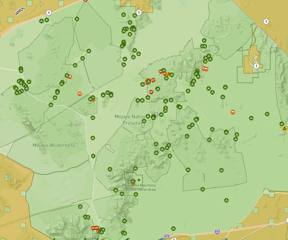
Know before you go
Our Field Map shows you the things that matter when you're two hours from pavement. Dispersed campsites. Trusted mechanics. Fuel, water, propane, Wi-Fi. Trails with difficulty ratings. Public land boundaries so you know where you're allowed to be.
It is easy to import your GPX library from any other app. And every point on the map carries a What3Words address you can read over the radio or send in a low-signal text.

DOWNLOAD OVERLAND BOUND ONE


The trail is better with Overland Bound

Plan trips, find your crew, map the ground you’re headed for, and share the road with people who’ve been there. Membership is $39.99 a year. Your member number is yours for life.

field map
Know before you go
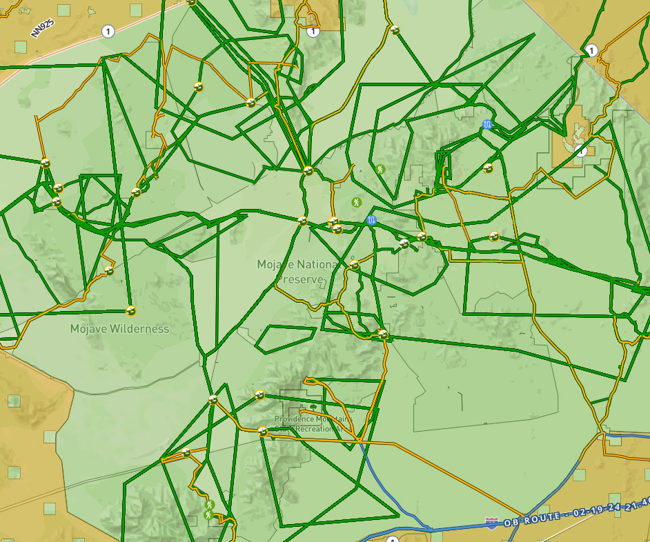
See trails, dispersed campsites, trusted mechanics, fuel, water, and the rest of what’s out there, before you leave the pavement.
Land management layers show you where you’re allowed to go. Member dots show you who’s nearby. Bring in GPX files from any other app you’ve been using.
Community forums
Ask someone who’s been there
Over a decade of overlanders answering each other. Gear questions, recovery stories, regional knowledge, build threads, and the kind of help you only get from people who’ve actually done it. No ads. Ever.


Rally Point
Make the trip actually happen
Plan the trip, set the route, tag the terrain, name the comms channel and invite your crew. Public if you want more rigs. Private if you don’t. Every Rally Point keeps the plan, the waypoints, the discussion, and the RSVPs in one place, so the group text can go back to being a group text.
Premium Membership Features
Go farther.
Go prepared.
With features like offline mode, trail recording, and premium map layers, membership gives you the off-grid features you need to explore further.
| Features | Free | MEMBER |
|---|---|---|
| View map points of interest and locations | ||
| Access to our ad free community forums | ||
| On and Off-road navigation | ||
| Road, off-road, hike and 'as the crow flies' tap and snap route planning | ||
| Download, import and share GPX tracks | ||
| Record your track and create GPX files | ||
| Offline mode | ||
| Full access to map layer library | ||
| Community support alert | ||
| Tools to organize Overland Trips and Meetups | ||
| Download offline map layers | ||
| Community messaging tools |

Membership Features
Go Further.
Go Prepared.
With features like offline mode, trail recording, and premium map layers, membership gives you the off-grid features you need to explore further.
| Features | Free | Premium |
|---|---|---|
| Map points of interest and locations | ||
| Access to our ad free community forums | ||
| Tools to organize Overland Trips and Meetups | ||
| On and Off-road navigation | ||
| Trail recording features | ||
| Download and share GPX tracks | ||
| Offline mode | ||
| Premium map layers | ||
| Download offline map layers |
community focused
It doesn’t matter what you drive
Our global community is here to help you prepare for your next journey, whether it’s your first one or your latest one. We are an activity focused organization, not a vehicle specific one.
While it doesn’t matter what you drive, it does matter where you’d like to drive it. Helping you prepare for a safe and enjoyable journey is what we are here for.
Ad free forums and maps
It’s like a 24/7 virtual campfire filled with trail stories, images, gear recommendations and freely offered advice. And no ads. Ever. (We’re serious about this.)
Private means private
We offer all the benefits of social media and community forums without making you a product to sell to other companies. Please ‘like’, comment and search as you wish.
Map updated daily
New trails, points of interest, locations and services are added daily to the resource map, including frequent updates to Motor Vehicle Use Maps (MVUMs).
FEATURED ARTICLE
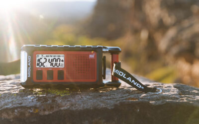
Gear Review: Midland ER310PRO Emergency Weather Radio
Midland ER310PRO Emergency Weather Radio The Midland...
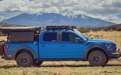
Opinion: Would I Buy Another Ford Raptor?
This weekend I rolled out of the McDonald’s drive thru...
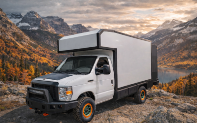
Globe Trekker Sends the Ford E-Series Off-Road
Globe Trekker’s New Camper Platform Promises to Get You...
connect with us